StereoSys Overview
The world’s unique and easily used Stereo Viewing software
 |
S3DGIS version 16.0 gives you the world’s easiest way of stereo-enabled image viewing software. There are lots of GIS, RS & Photogrammetry software out there with lots of stereo & image handling functions, features which cannot be easily maneuvered by most of the people. Users want software, which is easy to use, requires less training, and provides them with wonderful and satisfactory experience in stereo and image handling even with limited functionalities. | 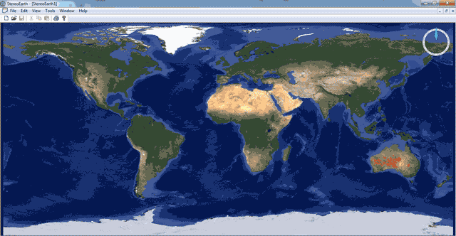 |
| StereoSys takes advantage of readily available WMS (Web Map Services) on internet and gives them unbelievable 3D power by enabling stereo for them. Do not worry if your system is not stereo enabled. Our ‘Anaglyph’ mode can provide you that experience with basic Anaglyph glasses (red-blue glasses as we used to say in childhood !!!). Users having their own georeferenced imagery data also can load them in StereoSys software to enjoy stereo 3D view. The software takes advantage of universally available global DEMs like ASTERDEM, SRTM, CARTODEM etc for elevation data. | ||
 |
Salient features :
|  |
Features:
In StereoSys, the main backbone to view stereo is WMS offered by various players. User can choose “Openstreetmap” / “Virtual Earth” / “Google maps” / “Google Hybrid” / “Google Sat” or even their own WMS.
StereoSys can also enable stereo for user loaded geo-referenced aerial / satellite images taking advantage of loaded elevation data. Hence there is a real 3D visual effect and makes digitization realistic.
User can keep all his elevation data in a particular folder and give the details in “Edit” menu “-->Preferences” option.
By default, the system is enabled for “anaglyph” but the user can alter it to “Stereo” in “Edit” “-->Preferences” option.
Conversion of workspace from 2D to 3D and vice versa is very easy. Just Click right button of mouse and select the option “2D / 3D”. It toggles the screen / workspace from 2D to 3D and vice versa.
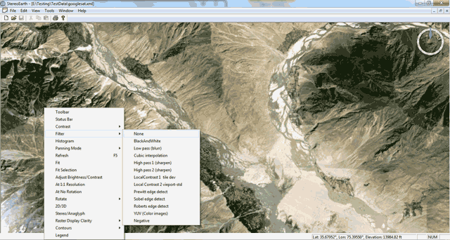
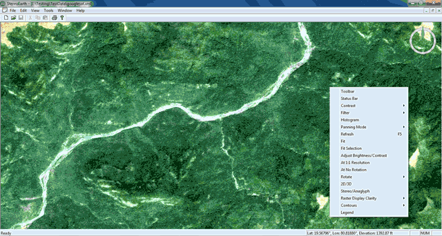
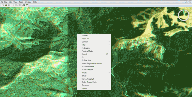
User can use various image filters to enhance the loaded images (either local or WMS). The enhancements happen on the fly so that the user need not spend time and resources separately.
User can enter into Roaming (here termed as “panning mode”) or standard cursor movement just by toggling. Most of the features are given at the right button of mouse, so that user need not go back to menu options each time. User can lock “X” or “Y” direction during fly through simulation. User can choose either “selection” or “random”
Formats Supported:
All generally accepted international standard formats are supported in StereoSys. Here is a list of formats supported by our software.
Raster Image Formats
| ADRG | NIMA ARC Digitized Raster Graphics |
| AVHRR | Advanced Very High Resolution Radiometer Level 1 B, .l1b |
| ADF | ESRI .adf format, also sometimes called ArcGrid format. Note that .adf files can contain either raster or vector data. |
| BMP | Windows bitmap, .bmp |
| CADRG | NIMA Compressed ARC Digitized Raster Graphics |
| CIB | NIMA Controlled Image Base |
| CSV | Images as virtual tables in comma-separated or other text file tables. |
| DB | Images as virtual tables in Borland Paradox files |
| DBF | Images as virtual tables in dBase, FoxPro files |
| DNG | An Adobe variation of TIFF used in digital photography. |
| DOQ | USGS Digital Orthophoto Quadrangle, .doq, .coq, .jpg |
| DRG | USGS Digital Raster graphics (scanned maps) in .tif format (used for DRG';s by USGS). |
| DSN | Images as virtual tables in Microsoft Data Source files, .dsn |
| E00 | ESRI .e00 files containing rasters. |
| ECW / JPEG2000 | ERMapper .ecw Wavelet compressed or JPEG2000 compressed format. Any size ECW or JPEG2000 image may be imported. |
| EMF, WMF | Windows Meta File and Extended Meta File, .emf, .wmf |
| ENVI IMG | ENVI .img format image files. |
| ERDAS GIS | ERDAS files in .gis, .lan formats. |
| ERDAS IMG | ERDAS .img format image files. |
| ERS | ERMapper .ers files. |
| GIF | A well-known image format, .gif |
| GeoSPOT | GeoSpot satellite multispectral rasters |
| GRASS | US Army Corps of Engineers raster-based package. |
| GXF | Geosoft .gxf, an ASCII grid format mainly used for terrain elevation data. |
| HTML | Images as virtual tables in HTML files. |
| HDR | GeoSPOT satellite files, .hdr |
| HDF | SeaWiFS, EOS, NCSA (National Center for Supercomputing Applications) Hierarchical Data Format (HDF). Used mostly for images. Used widely in Earth Observation Satellite (EOS) projects. |
| IDRISI IMG | IDRISI .img format. |
| IMDISP | US AVHRR / Conterminus US Land Cover, .lbl |
| JPEG | A well-known image format, .jpg, .jpeg. |
| LAS/LBL | Log ASCII Standard (LAS) format used for well logging data. An ASCII format originally developed by the Canadian Well Logging society in the late 1980's and now used by USGS and others, .ddr |
| MDB | Images as virtual tables in Microsoft Access 2000 or Access 97 .mdb format |
| NITF | NIMA .ntf image format (different than UK Ordance Survey .ntf) |
| PCX | PC Paintbrush format by ZSoft, .pcx |
| PIX | PCIDISK, Silicon Graphics Alias / Wavefront .pix format |
| PNG | Portable Network Graphics (pronounced "Ping"), .png - Just say no to .gif! |
| PPM | Portable PixMap (PPM) format. Intended as a "lowest common denominator" color image file format. Used in UNIX systems, .ppm |
| RAW | Raw text and raw binary files, .raw |
| IDRISI32 RST | IDRISI .rst format files |
| SGI | Silicon Graphics .sgi format files |
| SID | "MrSID" images using LizardTech proprietary format. Requires prior installation of any one of several free import utilities. .sid |
| SPOT | SPOT satellite .dat format files |
| SRTM | Shuttle SRTM data in .hgt, .inc,.mag, .pol and .err files. |
| SUN | Sun Microsystems .sun files |
| TAB | MapInfo TAB grid files, .tab |
| TGA | Targa .tga files |
| TIF | Regular .tif, .tif with .tfw "world files", etc. |
| TIFF .tif (geocoded) | GeoTIFF, regular .tif, .tif with .tfw "world files", etc. |
| UDL | Images as virtual tables in a Microsoft Universal Data Link connection, .udl |
| WKx | Images as virtual tables in Lotus files, .wj, .wk |
| WMF | Windows Meta File (see EMF), .wmf |
| WMS | Links to images served by OGC WMS servers. |
| XLS | Images as virtual tables in Microsoft Excel files, .xls |
| XLSX | Images as virtual tables in Microsoft XLSX files (Microsoft Office 2007 and later), .xlsx |
| XYZ | Generic XYZ |
| ADO.NET | Images as virtual tables via generic ADO.NET data sources |
| ADO.NET ODBC | Images as virtual tables via ODBC through ADO.NET |
| ADO.NET OLE DB | Images as virtual tables via OLE DB through ADO.NET |
| ADO.NET Oracle | Images as virtual tables via ADO.NET built in connection to Oracle. |
| ADO.NET SQL Server | Images as virtual tables via ADO.NET built in connection to SQL Server |
| Oracle Data Sources | Oracle Call Interface (OCI) for direct connect to Oracle tables or Oracle Spatial storage using GeoRasters. Requires Enterprise Edition or above. |
| ODBC | Images as virtual tables via any ODBC driver. |
| OLE DB | Images as virtual tables via any OLE DB Provider. |
Vector Formats
| ADF | ESRI .adf format, also sometimes called ArcGrid format. Note that .adf files can contain either raster or vector data. |
| BNA .bna | Atlas |
| CSV .csv, .asc, etc. | Comma-separated tables containing vector information |
| DB .db | Database files containing vector information |
| DBF .dbf | Database files containing vector information |
| DGN .dgn | Intergraph |
| DSN .dsn | Microsoft data source files providing connections to data sources containing vector information |
| DLG .dlg, .opt | USGS Digital Line Graph Optional |
| DWG .dwg | AutoCAD versions 13, 14, and 15 |
| DXF .dxf | AutoCAD versions 13, 14, and 15 |
| EOO .e00 | ESRI ArcINFO "export" format. All editions can read .e00. Writing .e00 equires Enterprise Edition or above. |
| ESRI Geodatabase | ESRI "geodatabase" format using .mdb |
| GDF .gdf | European common format |
| Geocoding Database | Manifold Geocoding Database files for import of roads, hydrography, etc. Requires Geocoding Tools extension. |
| GML .gml | Ordnance Survey (UK) version of GML used in MasterMap. GML may well be the utterly stupidest format ever created by a committee of bureaucrats. |
| HTML | Database files containing vector information |
| IDRISI VCT | Idrisi vector format files |
| KML/KMZ | Google Earth "Keyhole" KML and KMZ |
| LULC | GIRAS |
| MAP | Manifold 5.00 or 5.50 .map project files |
| ETAK MapAccess | Proprietary ETAK format (Acquired by TeleAtlas) |
| ETAK MBS .mbs, .xbs | ETAK MapBase (Acquired by TeleAtlas) |
| MDB | Microsoft Access MDB database files containing vector information |
| MFD .mfd | Manifold 4.50 |
| MIF .mif | MapInfo mid/mif |
| MWS | Manifold 4.50 workspace files |
| NTAD .are, .lnk, .nod, .pnt | BTS National Transportation Atlas Database |
| NTF .ntf | UK Ordnance Survey including several NTF subformats. |
| S57 | Vector format popular for marine navigation, a "bare bones" importer aimed at grabbing core vector information. |
| STDS | US government Spatial Data Transfer Standard |
| SHP .shp | ESRI ArcView, including 3D and measured Shapefiles |
| TAB .tab | MapInfo Tab, including shapefiles referenced by a TAB file. |
| TAIF .nde, .edg, .fac | Tele Atlas Interchange Format, Street Net, Multi Net |
| TIGER/Line | US Bureau of the Census TIGER (TL '95, '97, '98, '99, '00 and '00 Redist, 2002, 2003, 2004, 2005, 2006, 2006SE) |
| UDL | Microsoft Universal Data Link files providing connections to data sources containing vector information |
| VCT .vct | IDRISI |
| VMAP .dht | NIMA Vector Product Format: VMAP0, VMAP1 and VMAP2 (.vpf) |
| WKx .wj, .wk | Lotus database files containing vector information |
| XLS .xls | Microsoft Excel database files containing vector information |
| XLSX .xlsx | Vector information in Microsoft XLSX files (Microsoft Office 2007 and later), .xlsx |
| ADO.NET | Generic ADO.NET data source containing vector information |
| ADO.NET ODBC | ODBC through ADO.NET containing vector information |
| ADO.NET OLE DB | OLE DB through ADO.NET containing vector information |
| ADO.NET Oracle | ADO.NET built in connection to Oracle containing vector information |
| ADO.NET SQL Server | ADO.NET built in connection to SQL Server containing vector information |
| ODBC | Any ODBC driver providing connections to data sources containing vector information |
| Oracle Data Sources | Oracle Call Interface (OCI) for direct connect to Oracle tables or Oracle Spatial storage using SDO_GEOMETRY. Requires Enterprise Edition or above. |
| OLE DB | Any OLE DB Provider providing connections to data sources containing vector information |
Surface / Elevation Formats
| ADF | ESRI .adf format, also sometimes called ArcGrid format. Note that .adf files can contain either raster or vector data. |
| AVHRR .l1b | Advanced Very High Resolution Radiometer Level 1 B |
| BIL .bil, .hdr | ESRI BIL surfaces/terrain elevation |
| CEOS .vdf | SeaWiFS Satellite |
| CSV | Surfaces as virtual tables in comma-separated or other text file tables. |
| DAT .dat | SPOT files |
| DB | Surfaces as virtual tables in Borland Paradox files |
| DBF | Surfaces as virtual tables in dBase, FoxPro files |
| DDR .ddr | LAS files |
| DEM | USGS Digital Elevation Module |
| DEM STDS | USGS DEM using Spatial Data Transfer Standard |
| DEM ArcInfo .dem, .hdr | ESRI ArcINFO |
| DEM GLOBE | Global Land One-kilometer Base Elevation |
| DEM GTOPO30 | Global 30 Arc Second Elevation Data Format |
| DSN .dsn | Surfaces as virtual tables in Microsoft Data Source files |
| DTED | Digital Terrain Elevation Data (US Military / NIMA), DTED Level 0, Level 1, Level 2 |
| E00 .e00 | ESRI .e00 Grid files |
| ENVI IMG .img | ENVI IMG |
| ERDAS GIS .gis,.lan | ERDAS |
| ERDAS IMG .img | ERDAS |
| ERS .ers | ERMapper |
| ESRI ASCII Grid GRD .grd | ESRI ArcINFO ASCII Grid |
| ESRI Fload Grid FLT .flt | ESRI ArcINFO Floating-Point Grid |
| GeoSPOT .hdr | GeoSPOT satellite |
| GRC .grc,.grd | Northwood GRC/GRD Grid Files |
| GRASS | US Army Corps of Engineers |
| GXF .gxf | Grid Exchange File |
| HDF .hdf | EOS |
| HDF .hdf | SeaWiFS |
| HDR .hdr,.img | ENVI IMG |
| HDR .hdr | GeoSPOT |
| HTML .htm, .html | Surfaces as virtual tables in HTML files. |
| IMG .img | IMDISP |
| IMG .img | IDRISI IMG |
| GRC .grc | Northwood Grid Files |
| LULC CTG .ctg | Land Use and Land Cover |
| MDB | Microsoft Access MDB database files containing vector information |
| NTF .ntf | NTF Grid |
| PIX .pix | PCIDISK, Silicon Graphics Alias / Wavefront .pix format |
| RAW ASCII | Flexible format raw ASCII |
| RAW Binary | Flexible format raw Binary |
| SDTS | Surfaces in Spatial Data Transfer Standard (SDTS) format. |
| SRTM | Space Shuttle terrain elevation data in either 30 meter or 90 meter resolution. |
| Surfer GRD | Surfer 6, 7 or ASCII GRD files, automatically recognizing the correct Surfer format. |
| TAB .tab | MapInfo TAB grid files |
| TIF .tif | Geocoded TIFF, generic TIF as surfaces |
| UDL .udl | Surfaces as virtual tables in a Microsoft Universal Data Link connection. |
| VDF .vdf | CEOS SeaWiFS |
| WKx .wj, .wk | Surfaces as virtual tables in Lotus files. |
| XLS .xls | Surfaces as virtual tables in Microsoft Excel files. |
| XLSX .xlsx | Surfaces as virtual tables in Microsoft XLSX files (Microsoft Office 2007 and later), .xlsx |
| XYZ .xyz | Generic XYZ |
Students Zone
Special academic pricing is available exclusively for students and Educational institutions. Please contact for the same at sales@s3dgis.com with subject “StereoSys – Student’s / Educational purpose”.
Please do not forget to mention the following details…
For Students:
- Student Name:
- Student Enrollment number:
- Student E-mail id:
- School / College Name:
- School Address:
For Educational Institutions:
- Educational Institute Name:
- Department Name:
- Contact person Name:
- Contact person E-mail id:
(Note: If college has own website, then E-mail id should belong to college website)
- Institute Address:
Latest Updates
StereoSys, as a product travelled long way from when it was envisaged to the present version. There were lot of trials, successes, failures & upgrades in order to make an efficient, robust but lightweight (memory wise) software.
StereoSys Ver 16.0.0 Build 12 is the latest update in ever improving programme.
Please mail us at sales@s3dgis.com if you wish to try our software before purchase
Support
We have made every effort to make our product to be reliable, user friendly and easy to operate. Still some unforeseen issues may crop during its usage. Hence we are always there to assist you in resolving issues either installation or usage wise.
For any technical issues, please contact us at support@s3dgis.com